Legis. Rudy Sunderman, in conjunction with the Nature Conservancy, is surveying Mastic, Mastic Beach and Shirley residents on flood patterns surrounding the Mastic-Mastic Beach-Shirley Conservation Area. The effort is to get a larger picture of how the coastal region has changed and how the county can better protect homes, wetlands, and sensitive areas.
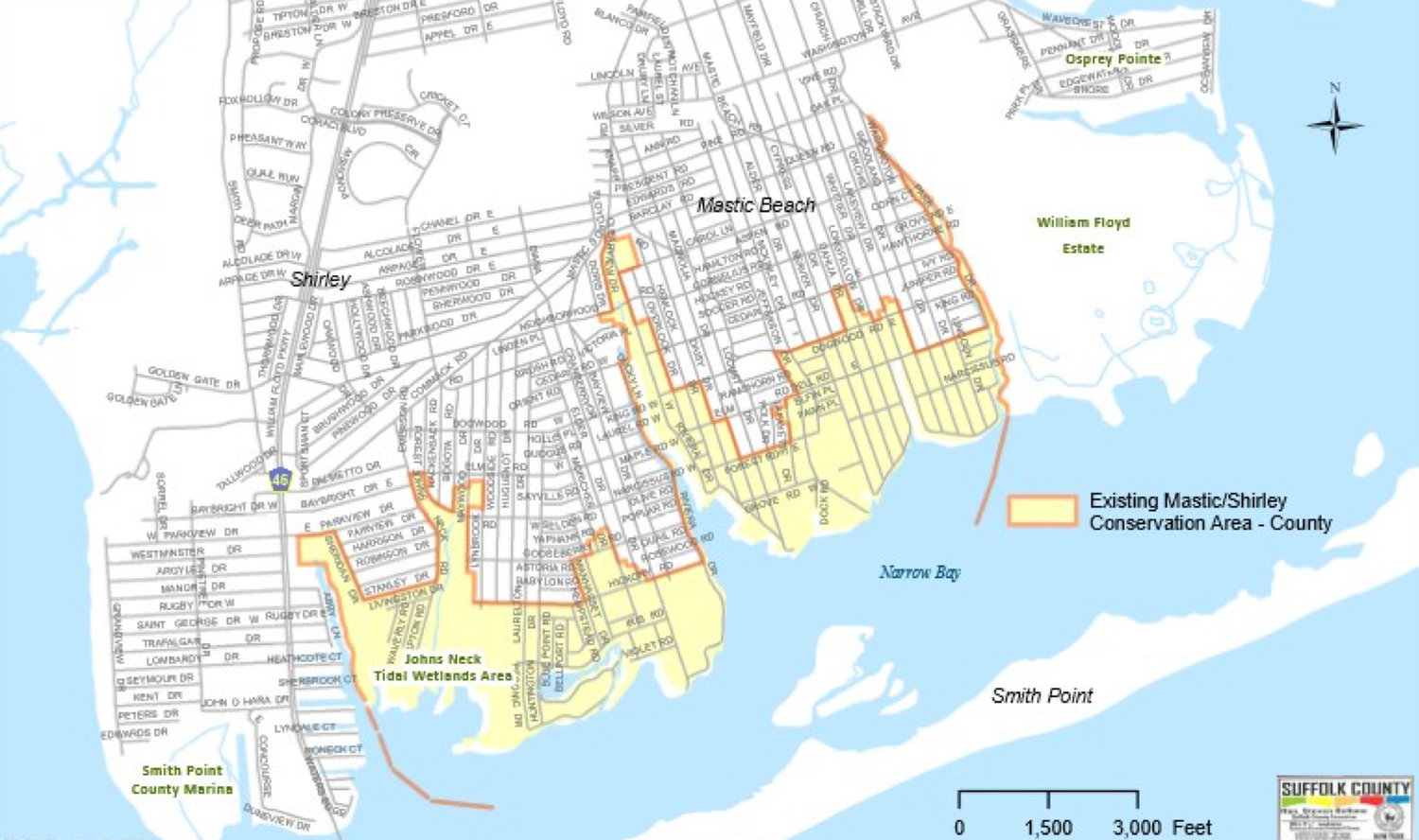
The current boundaries were previously drawn in the wake of Superstorm Sandy, and as multiple environmental factors have changed in the area, Sunderman felt it might be time to look at new data to update the map.
“It is important to me that I receive feedback from the community,” Sunderman said. “The residents are the eyes and ears of the neighborhood and their personal experiences dealing with these issues is critical to reassessing the designated conservation zone.”
Two survey sessions took place recently that allowed residents to fill out forms related to their experience with flooding. For those not able to make the two sessions, surveys are still available by contacting Sunderman’s office. You will get a form that asks to mark where flooding occurs on a daily basis or during a storm surge. Survey takers can also notate any areas they feel deserve to be protected. The conservation area already covers the southern portion of the tri-hamlet region, including the banks up the Forge River. The easterly border is the William Floyd Estate and reaches west to William Floyd Parkway. Smith Point County Park and the Fire Island region are not included in the protected area.
The area has been a focus of Suffolk County’s efforts to purchase and preserve wetlands in an effort to curtail coastal flooding. The Nature Conservancy, a nonprofit focused on environmental issues, has been assisting with restoring the resiliency of Mastic Beach, especially around its wetlands.
“It is the everyday flooding that’s changed our way of life,” reads a guide to recovery by the Conservancy. “From wading to your house in floodwater to having to park in a different spot every day, locals know all too well how their daily life is affected by water with no place to go.”
Answers from the surveys will be used to redraw the borders of the Conservation Area. Surveys are being accepted through the last week in September. They can be filled out and either dropped off at Sunderman’s office or emailed to Tim Rothang at tim.rothang@suffolkcountyny.gov.


Comments
No comments on this item Please log in to comment by clicking here