On Thursday, May 12, Suffolk County held a virtual meeting and public information session over Zoom regarding the plans for the new Smith Point Bridge, since several components of the project have …
This item is available in full to subscribers.
We have recently launched a new and improved website. To continue reading, you will need to either log into your subscriber account, or purchase a new subscription.
If you had a login with the previous version of our e-edition, then you already have a login here. You just need to reset your password by clicking here.
If you are a current print subscriber, you can set up a free website account by clicking here.
Otherwise, click here to view your options for subscribing.
Please log in to continue |
|
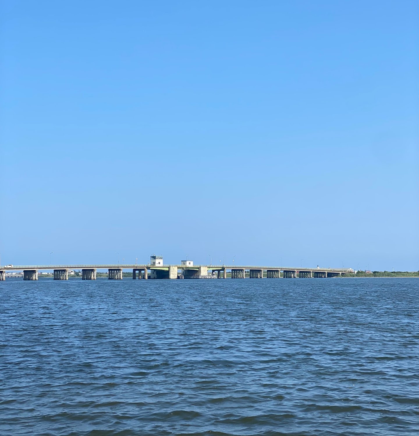
On Thursday, May 12, Suffolk County held a virtual meeting and public information session over Zoom regarding the plans for the new Smith Point Bridge, since several components of the project have changed since the public meeting held in 2016.
The Suffolk County Department of Public Works is proposing to replace the existing Smith Point Bridge with a new high-level fixed bridge built along an alignment slightly to the west of the existing bridge. The project is being funded in part with money from the Federal Highway Administration. After the completion of the new bridge, the existing bridge would be removed.
The existing Smith Point Bridge opened to traffic in 1959 and is owned by Suffolk County and carries William Floyd Parkway over Narrow Bay in the Town of Brookhaven. The bridge provides the only vehicular access to Smith Point County Park, Outer Beach, and the east end of Fire Island National Seashore. The bridge endures heavy usage during the summer months and has received numerous repairs and rehabilitations, but issues still persist. Smith Point Bridge is the lowest-rated bridge owned by the county.
At the start of the meeting, Suffolk County Legis. James F. Mazzarella spoke about the importance of the project.
“By replacing the old Smith Point Bridge, we are ensuring that we have continued access to the most beautiful and most visited park in all of Suffolk County,” Mazzarella said. “We’re fortunate to have been allocated federal infrastructure monies that will fund 80 percent of the cost of the total project. The new bridge will not only provide access to our barrier beach, but more than that it will be an amenity for the community.”
The current Smith Point Bridge has widespread deterioration to concrete approach beams, frozen bearings and deteriorating deck joints, a bascule pier that is open and low to the water causing extensive steel corrosion, bridge piers that are susceptible to scour and seismic events, obsolete operating mechanical and electrical equipment and a load posting of 15 tons.
The new bridge will feature a 12-foot-wide shared-use path across the bridge, a fishing pier below the bridge, and whale’s tale hammerhead pier. The current bridge is a drawbridge that opens to accommodate large vessels, but the new bridge would be at a higher elevation and therefore not need to open for large vessels.
Bill Nyman, of the county’s prime consultant Hardesty and Hanover, said the county is trying to decide whether to put the shared-use path on the east or west side of the bridge. The path would be protected from traffic by a concrete traffic barrier and would accommodate both pedestrians and bicyclists.
“If we put it [the shared-use path] on the west side, the residents on the east of William Floyd Parkway need to head north and cross over William Floyd Parkway at the intersection to access the shared-use path, and there’s also more indirect access to Smith Point County Park and Fire Island at the south end,” Nyman said.
“If we put the shared-use path on the east side, residents east of William Floyd Parkway have direct access to the shared-use path and there’s improved access to Smith Point County Park and Fire Island at the south end.”
If the shared-use path was put on the west side, at the south end of the bridge pedestrians and cyclists would have one of three choices. The first choice would be to take a crosswalk across the parkway (there would be no traffic signal at the location); then they would proceed to walk down to the parking lot where they would go underneath the existing underpass to access the beach. The second option would be to continue to the traffic circle along an existing path and cross two roadways, where the crosswalks go around the traffic circle and then get to the beach that way. The third option would be to double back into the under-utilized area, cross into a new underpass and enter the back of the parking lot, where cyclists or pedestrians would then proceed to go along the parking lot to get to the other underpass. Nyman noted that it is “not our preferred option to have the path on the west side.”
If the shared-use path was put on the east side of the bridge, the path at the south end of the bridge would move along the bridge and then pass along the back end of the parking lot and down underneath the existing underpass. It would be a direct and safer route across the bridge and then through the underpass to the beach without having to cross traffic. On the north end, the shared-use path would be able to be accessed directly from the neighborhood, so individuals who live in the area would have direct access to the shared-use path and the bridge to the beach.
The fishing pier that would be included with the new bridge would be a low-level fishing pier directly accessible from points around the north shore of the bridge. The pier would extend about 300 feet out into the bay, be ADA accessible and be a shaded area. Nyman noted that it has been proposed that access to the fishing pier be provided via a path from a parking area. He said several options are being explored. The first option would be to expand the current parking lot at the park ranger house to accommodate additional cars. It would be an approximately 700-foot path from this location to the fishing pier. The second option would be to utilize the current parking lot at the Smith Point County Marina, which would be an approximate 1,000-foot-long path to the fishing pier.
The in-water construction activities that would take place during construction would include a floating barge with mounted equipment for deep water work, temporary trestles for shallow water work, temporary sheet pile cofferdams for pier foundation work, an erosion and sediment control plan, mitigation of wetland impacts and federal agency permit applications and requirements. In late 2022, the bridge plans will undergo a NEPA reevaluation to look back at the environmental studies that were previously done and see how any new changes would affect the project. The final design should be complete in mid-2023 with advertisement and bidding taking place in late 2023. Construction is slated to begin in mid 2024 and finish in 2027.
During the public comment portion of the meeting, numerous residents expressed concern about the shared-use path. Maura Spery, founder and chair of the Mastic Beach Conservancy, asked if there will be any way to separate cyclists from pedestrians. Planners noted that there will be a center stripe down the middle of the path for direction, but there will be no separate lanes for bikers and walkers. The current bridge has narrow sidewalks with no bicycle accommodations.
William Biondi, commissioner of the Mastic Beach Fire Department, asked about the max gross weight for the new bridge, noting that right now the firehouse only has two small trucks that can go over the bridge due to weight limits. Planners said the bridge would hold a standard highway load, but that they would speak further with the fire department on the matter. Biondi also asked who will make the final decision regarding putting the shared-use path on the east or west side. Nyman said the decision will be made by the Department of Public Works in conjunction with the county executive's office, and noted that public comment periods such as the meeting were important to receive community input.


Comments
No comments on this item Please log in to comment by clicking here